

A Missouri landmark shaped by wartime history and the families who once called this land home.
By Jill Szoo Wilson
Writer | Theatre Artist | Educator
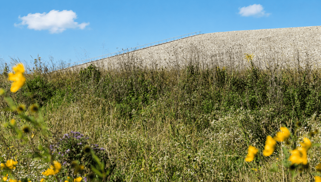
A mile south of Interstate 64 on Highway 94, St. Charles County holds a mountain with the geometric manners of a pyramid. Its broad sides rise in long planes of pale rock, each slope too even for geology, and a staircase runs straight toward the sky. A federal interpretive center sits at its foot amid native flowers and clean paths, with generous parking nearby. The setting feels like a roadside attraction designed by an engineer with a gift for understatement.
The mountain is the Weldon Spring Site disposal cell, a 75-foot structure containing 1.48 million cubic yards of chemical and radiological waste. It covers 41 acres and measures about a mile around. Visitors may climb it, circle it, study it through the exhibits, or use it as the start of a longer hike. The Department of Energy welcomes the public free of charge, complete with stairs and viewfinders at the summit. Missouri has turned stranger chapters into parks before. Weldon Spring gives its buried chapter an observation deck of its own.
Before the Fence
The story begins with communities. Hamburg and Howell stood across this countryside, while Toonerville occupied another corner of the same rural world. Farmhouses faced gravel lanes. Churches and one-room schoolhouses gave shape to the calendar, and Francis Howell High School gathered students from the surrounding farms. Electricity arrived in 1935, and new bridges opened fresh routes. As the Depression eased, local families found a real reason for confidence.
The place held far more life than a government map could show. Bettie Yahn-Kramer, whose family left during the federal acquisition, told First Alert 4 that her mother remembered “vibrant towns,” with doctors, a mortician, teachers, and “music in every home.” A photograph of the 1928 Howell women’s baseball team preserves another piece of that life: uniforms, crossed arms, bright socks, steady faces. Roughly 700 people lived among the three communities, some with family roots reaching back more than 140 years.
The most vivid response to the government’s arrival came from William Snyder, a landowner in his nineties who had lived through the Civil War and could measure this moment against a long lifetime of American history. According to The TNT Story, an archive maintained by descendants of the displaced families, Snyder wired the Secretary of War directly, protesting the treatment of “sacred covenants with its citizens,” a phrase that captures the wounded pride of an entire community in a single line. At a packed meeting in Howell, the same archive records a local congressman telling the crowd the government’s mind was made up, offering only, “We are sorry.” One farmer answered that if the courts sided against him, “we are going to move back on our land.”
Then the war arrived as stationery. On October 11, 1940, landowners received letters giving them 45 days to leave, with compensation promised for their property. Some families accepted the offer as their part of the national effort. Others petitioned President Roosevelt and asked for enough time to let the school year finish. Families sold livestock and household goods in street auctions, and payment sometimes trailed them by weeks or months, arriving well past moving day. By the summer of 1941, the federal government controlled roughly 17,000 acres.
That short deadline carries the emotional weight of the whole landscape. A farm can pass through a family for generations, accumulating fences, fruit trees, recipes, nicknames, and graves. A federal letter measures the same place in acreage and days. At Weldon Spring, patriotism and dispossession entered the mailbox together.
A Five-Year Fight for a Fair Price
Money became its own battle, and a long one. Families ordered out within ten days or a few months often waited years for a government check to arrive, and many turned to the Farm Security Administration once local banks grew reluctant to extend credit. Landowners organized and petitioned Washington. Nearly nine hundred of them packed a mass meeting at a Weldon Spring church. Their case climbed all the way to the U.S. Supreme Court, which ruled in their favor in 1945, five years after the first eviction letters went out, a result also recorded in St. Charles County’s official history. A bittersweet coda followed: when the government later offered surplus land back for agricultural use, the old farms went instead to the state conservation commission, and former owners lost the chance to buy back the fields their families once worked.
Descendants have spent decades piecing the story back together, gathering photographs and family scrapbooks into an ongoing community archive. Among its treasures are a family photo album and a personal scrapbook. These keepsakes restore faces, porches, kitchens, and Sunday clothes to a history flattened by government paperwork. A granite monument at the intersection of Highways 94 and D carries a quiet dedication to the families of Hamburg, Howell, and Toonerville, closing with a single wish: “Peace.”
A Factory Built at Wartime Speed
Construction began in early 1941, and the Weldon Spring Ordnance Works took shape with the startling speed of wartime industry. Roads and railroad spurs crossed the acreage. Production buildings rose behind barbed wire, while access to Highway 94 tightened around the new military complex. The U.S. Army placed Atlas Powder Company in charge of operations, and thousands of workers came through the gates, many commuting from towns across the county for wages that outpaced anything else the county had to offer.
The plant manufactured trinitrotoluene and dinitrotoluene, better known as TNT and DNT. Four TNT production lines occupied the area that later became the chemical plant. From 1941 through 1945, the countryside served as a backdrop to a conflict unfolding an ocean away. Farmland became a guarded industrial system built around explosive chemistry and speed, pursued at a national scale.
Production ended with the war, and much of the larger ordnance property eventually entered public use. Today, the August A. Busch Memorial Conservation Area and the Weldon Spring Conservation Area spread across former government acreage. Anglers cast into lakes created from old TNT-production water systems while hunters cross restored habitat. Families and birdwatchers follow trails through land once enclosed by military fencing.
The Cold War Moves In
In 1956, the Atomic Energy Commission acquired part of the former ordnance property for a uranium-processing plant. The new operation refined uranium feed materials and handled smaller quantities of thorium. Its workers occupied a different national emergency shaped by reactors, weapons programs, technical secrecy, and the expanding architecture of the Cold War.
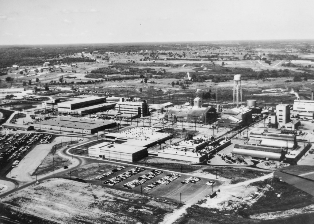
Uranium processing created a liquid byproduct called raffinate, which collected in four large pits at the chemical plant. A separate limestone quarry, roughly four miles southwest, had already received burned explosives waste and TNT-contaminated rubble from the wartime plant. Between 1963 and 1969, the Missouri Department of Natural Resources notes, the quarry also received uranium and thorium residues in drums and loose material. The histories of the two sites eventually converged inside a single disposal cell.
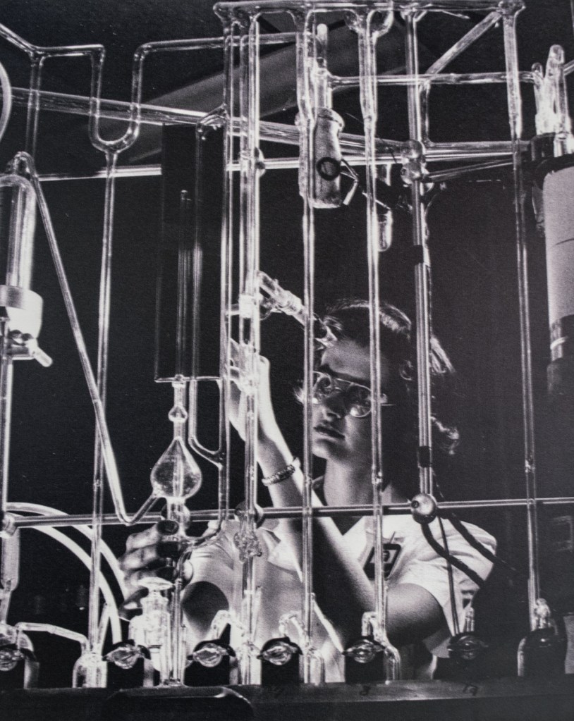
Uranium production ceased in 1966. A later Army plan prepared the site for herbicide production, then ended during the preparation stage, and the buildings entered caretaker status.
Building the Mountain
By the 1980s, the scale of the legacy demanded a federal cleanup. The Environmental Protection Agency placed the quarry on the Superfund National Priorities List in 1987, followed by the chemical plant area in 1989. Engineers and cleanup crews dismantled the plant and excavated the raffinate pits. A private haul road carried quarry material along an old rail spur, keeping bulk waste away from public roads. Sludge became a cement-like grout, then joined contaminated soil and demolition debris inside an engineered disposal cell.
The cell rose through deliberate layers. Clay and synthetic lining formed its containment system. A rock cap created the sloping surface visible today, while a collection system captured liquid from inside the structure for treatment. Construction finished on October 23, 2001. The result held decades of contaminated material inside a 41-acre footprint and gave St. Charles County a new summit.
The Missouri Department of Natural Resources describes the active cleanup as complete, with the site continuing under long-term federal stewardship. Groundwater monitoring and periodic reviews remain part of that work. The distinction matters because the mountain represents an ongoing responsibility as well as a finished construction project.
Prairie at the Foot of the Cell
Here, the story acquires an unexpected softness. Howell Prairie spreads around the disposal cell in bluestem and flowering plants. Meadowlarks lift from the grass while butterflies move through the garden. Along the path, benches invite visitors to linger beside a federal radioactive-waste repository. The Hamburg Trail begins nearby and connects with regional trail systems, including the Katy Trail. A former industrial haul route now carries bicycles and hiking shoes.
The prairie serves a purpose beyond scenery. Deep-rooted native plants stabilize soil and create habitat across land once defined by industrial production. Their seasonal rhythm gives the site a living calendar: green shoots in spring, tall flowers in summer, copper grasses through autumn, and seed heads holding snow. The mountain keeps its severe geometry as the prairie changes around it.
That pairing gives Weldon Spring much of its charm. The site presents the machinery of remediation alongside the ordinary pleasures of a Saturday outing. Children race up the stairs while birders scan the grass. Cyclists pause at the trailhead as families choose a path through the prairie. Descendants of the original families sometimes stop by too, tracing old property lines on the historical maps and pointing out where a grandmother’s kitchen once stood. History waits beneath every step, contained inside the largest object in the landscape.
The View from the Top
From the summit, St. Charles County opens in wide bands of prairie, woodland, rooftops, and sky. The viewfinders point toward distant landmarks, and the disposal cell’s flat top creates the curious sensation of standing on a civic terrace. The climb gives those seventy-five feet surprising stature and makes the steady stream of visitors easy to understand.
The view also restores a sense of scale to the communities that came first. Somewhere across this acreage, families went to school and neighbors made music. Hamburg and Howell shared a network of farms and kinship that reached into Toonerville. The ordnance works absorbed that world in 1941, and the uranium plant added its own layer after the war. The disposal cell gathers the physical remains of those industrial years into one visible form. Archive keepers and descendants carry the human half of the story forward.
At the bottom of the staircase, native grasses brush the path. Above them, the steps hold their straight line against the mound, carrying another family toward the top of the history St. Charles County buried in plain sight.
Planning Your Visit
The Weldon Spring Site Interpretive Center is located at 7295 Highway 94 South, St. Charles, Missouri, about two miles south of the Highway 40/61 junction. Admission is free. The center currently opens from 9 a.m. to 5 p.m. Monday through Friday and from 10 a.m. to 4 p.m. on weekends, with holiday closures. The disposal cell, prairie paths, garden, and trail connections can turn a quick stop into a generous afternoon. Check the Department of Energy visitor page for current hours and site information as you plan your trip.
Further Reading
- First Alert 4 (KMOV): “Forced to Leave”
- The TNT Story
- St. Charles County official history
- Missouri Department of Natural Resources: Weldon Spring Site
- U.S. Department of Energy: Weldon Spring Site Fact Sheet
- U.S. Department of Energy: Weldon Spring Site Interpretive Center







Leave a Reply