
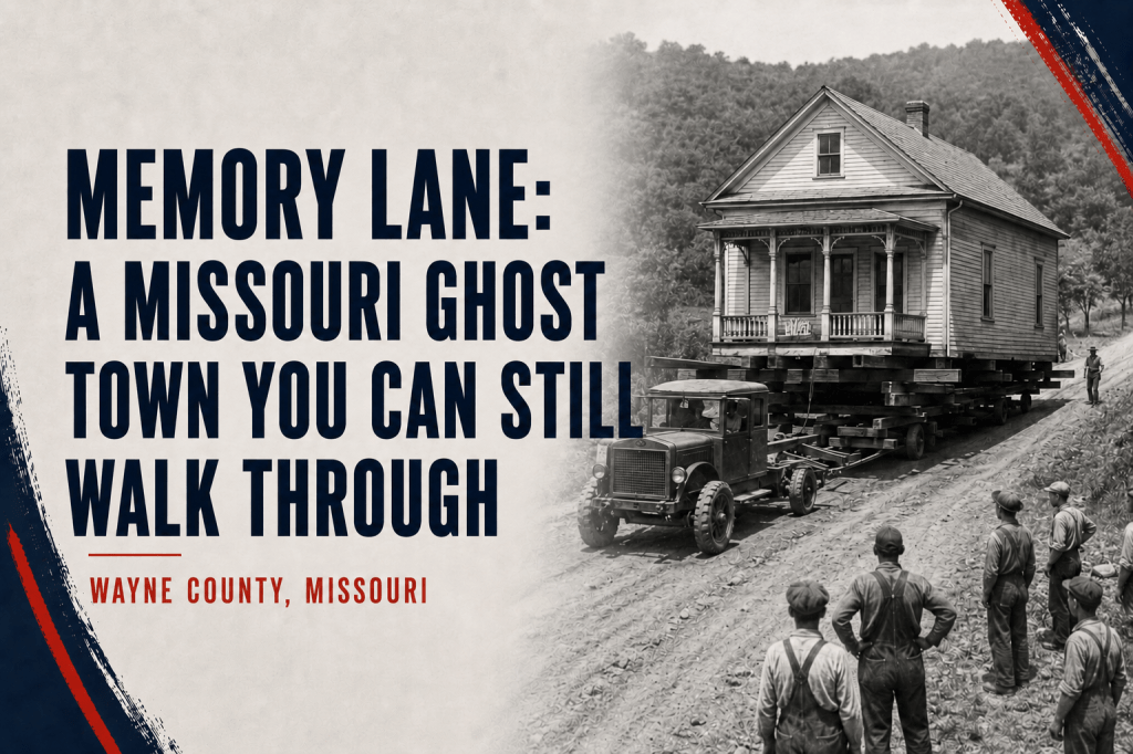
In 1941, the residents of a flood-weary Missouri county seat carried their houses two miles uphill. Their streets are still there.
By Jill Szoo Wilson
Writer | Theatre Artist | Educator
At the Greenville Recreation Area in Wayne County, history has a habit of interrupting the weekend. A camper heading toward the lake may pass a set of concrete steps rising toward a house that disappeared eighty-five years ago. A family out for an evening walk may find itself following Fourth Street, though the stores and porches once lining it have long since vanished. Somewhere near the picnic tables stood the Wayne County Courthouse. The jail was nearby, along with a schoolhouse, a lumberyard, and enough homes to make this ground feel like the center of the world to the people who lived here.
The U.S. Army Corps of Engineers calls the trail through the old town Memory Lane, a name that would feel sentimental almost anywhere else. Here, it is simply accurate. The one-mile path follows portions of Greenville’s original sidewalks, passing foundations and interpretive signs that show visitors what once stood beneath their feet. Portions of the recreation area lie within the roughly 180-acre Old Greenville historic site, which was listed on the National Register of Historic Places on February 17, 1990. The town has been gone since 1941, yet its streets continue receiving visitors. They simply arrive now with fishing poles and coolers.
Old Greenville served as the Wayne County seat for roughly 120 years before its residents made an extraordinary decision. Faced with a federal dam project and the prospect of even worse flooding, they chose to relocate the town two miles north. Around forty houses made the journey. Larger buildings came down, and the old town site became part of the flood-control landscape surrounding Lake Wappapello.
Greenville’s story would be remarkable for the move alone. During the years before the houses rolled north, however, the town also became home to a lumber empire built on company money, a murder scandal worthy of a courthouse serial, and a suffragist who rode the Ozarks on horseback. The river eventually decided the town’s geography, though generations of people had already given Greenville more history than its size would suggest.
The Town Hiram Holladay Built
During Greenville’s boom years, prosperity sounded like a sawmill and a train whistle.
Hiram N. Holladay arrived in Wayne County as a teamster hauling logs. In 1878, he purchased a small sawmill, then spent the next dozen years assembling an operation that touched nearly every part of the local economy. According to the historical marker at Old Greenville, Holladay’s holdings eventually included three stores, thousands of acres of timberland, iron mines, farms, lumber camps, a railroad, and more than one hundred rental houses. His company employed over seven hundred people. His Victorian mansion, known as Pine Place, stood as a conspicuous announcement that timber had been very good to Hiram Holladay.
The arrangement was considerably less generous to many of his workers. Holladay paid them in company-store coupons instead of cash and sometimes held their wages for sixty days. A man could work in Holladay’s mill, live in Holladay’s house, and buy his family’s food from Holladay’s store, arriving at payday to discover that much of his money had already found its way back to his employer. It’s the same arrangement Merle Travis would immortalize decades later in “Sixteen Tons,” with its famous line about owing one’s soul to the company store. Missouri’s labor commissioner investigated the practice twice during the 1890s, and the coupon system continued regardless.
Then, shortly after midnight on May 13, 1899, the empire lost the man at its center. Holladay was discovered in the bedroom of his wife’s sister and shot to death by her husband, Monroe Johnson. The resulting trial ended with Johnson convicted of fourth-degree manslaughter and fined $500, an outcome that suggests the jury had formed a rather firm opinion about the circumstances.
Holladay’s widow held the business together for several years before selling the railroad, mill, and remaining holdings in 1905 for a reported $1 million. The sale brought an end to the local empire, and Greenville’s economy gradually contracted along with the timber industry that had sustained it. By 1939, the population had fallen to nearly half its boom-era size.
The town remained the Wayne County seat, though, and daily life continued along its familiar streets. Children went to school, trains passed through, and families occupied houses built during Holladay’s prosperous years. Greenville had survived the death of the man who once seemed to own most of it. Its greater problem came from the river beside it.
The Suffragist and Her Horse
As Greenville adjusted to life after the lumber boom, a remarkable woman settled on a forty-acre farm east of town and began carrying a national political movement into the Missouri Ozarks.
Alice J. Curtice Moyer-Wing arrived in Wayne County in 1916 with her husband, Turner, and a history of reinvention already behind her. Widowed at thirty with two young children, she had taught herself stenography, worked as a traveling saleswoman, and joined the campaign for women’s suffrage. She later moved to St. Louis, where her speeches drew the attention of supporters and at least one violent opponent. In February 1916, a man confronted her on a city street, choked her, and threatened her life if she continued speaking publicly for women’s voting rights.
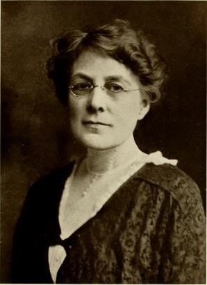
The threat failed to silence her. After settling near Greenville, Moyer-Wing mounted a horse named La Belle and rode into communities that sat well beyond the railroad’s reach, talking with families about suffrage and writing newspaper columns about the people she encountered. Her accounts appeared in the St. Louis Post-Dispatch between 1916 and 1919, with La Belle serving as companion, transportation, and occasional silent participant in Moyer-Wing’s observations. The surviving columns have an unexpected warmth to them. She wrote about politics, though she also wrote about roadside conversations and the humor of discovering that people rarely behave as neatly as an argument expects them to. Missouri Women has preserved several of those columns, including stories in which La Belle seems almost to share responsibility for the reporting.
After the 19th Amendment was ratified, Moyer-Wing carried her energy into electoral politics. During one campaign season, she delivered 343 speeches across 54 Missouri counties and served as a delegate to the 1920 Republican National Convention. The following year, Governor Arthur Hyde appointed her chief of Missouri’s Industrial Inspection Department, making her the first woman to lead a state department in Missouri. One state senator objected that the position was “no place for a woman.” She held it for years.
Moyer-Wing’s presence widens the picture of Old Greenville. This small Ozark county seat, reached by muddy roads and surrounded by timber country, became the home base of a woman who carried ideas across rural Missouri on horseback and later oversaw workplace inspections throughout the state. She died suddenly at her farm in 1937 and was buried in the countryside she had spent years traveling.
By then, Greenville was approaching a decision that would place every one of its residents on the road.
The River That Kept Returning
The St. Francis River rises in the St. Francois Mountains and flows south through one of Missouri’s oldest landscapes. Near Greenville, its clear Ozark water once passed through a relatively narrow floodplain before continuing toward the low country of southeastern Missouri and Arkansas. For the people who settled beside it, the river offered water, transportation, and fertile ground. It also kept returning to places where people believed they had built safely.
Greenville’s worst flood began in August 1915, after nearly a week of steady rain and a heavy downpour during the night of August 19. By the following morning, the St. Francis was rising at the astonishing rate of twelve inches an hour. At six that evening, the river spread through town, filling some homes and streets with five feet of water.
Residents moved livestock to higher ground and carried furniture upstairs. Families took refuge on the upper floors of the school, local businesses, and the homes of neighbors whose property sat slightly higher. Bridges and railroad structures washed away, cutting off passenger trains, mail delivery, and freight service. The county sheriff, stranded in St. Louis, traveled as far as Poplar Bluff and walked the remaining distance home. KRCU’s account of the flood describes a town that watched its ordinary geography disappear over the course of a single day.
The flood surpassed the previous record set in 1904, when heavy rain and the failure of a dam on Big Creek sent water through the area. Residents had regarded that earlier disaster as a limit, the sort of calamity a community survives once and then folds permanently into local memory. The river exceeded it eleven years later. Major floods came again in 1927 and 1935, each one strengthening the case for a federal flood-control project on the St. Francis.
Congress authorized that project in 1936 through the Overton Act, and the Army Corps of Engineers began constructing Wappapello Dam two years later. The dam would create an 8,400-acre reservoir at its normal level, with a much larger area available to hold floodwater when the St. Francis rose. Old Greenville sat near the reservoir’s northern reach, squarely within the landscape expected to absorb high water.
The project also produced an unusual chapter in Missouri archaeology. Before the reservoir filled, an undergraduate student from the University of Missouri named Carl Chapman conducted the state’s first government-funded archaeological survey of a reservoir area. Chapman later became one of the leading figures in Missouri archaeology and helped press for federal protections requiring archaeological work ahead of major public construction projects. Lake Wappapello would erase parts of the old landscape, but it also helped establish the practice of studying such places before the water arrived. Missouri Life recounts the history of the dam and Chapman’s survey.
Moving Day
A reservoir often grows familiar enough to resemble natural geography. After several generations, its coves acquire names, families return to the same fishing spots, and roads begin to look as though they were always meant to end at the water. Lake Wappapello began with engineering plans and a series of decisions about where floodwater would be allowed to go.
For Greenville, those plans brought the long argument with the St. Francis to an end. The town had already endured the floods of 1904, 1915, 1927, and 1935. Now its residents faced the prospect of living inside the flood pool of a federal reservoir, where high water could spread across the town site by design. In 1940, the community chose a new location on higher ground, two miles north.
The move began the following year. About forty houses were lifted from their foundations and hauled to the new town, among them the McAllister House, which appears in a surviving photograph balanced above the road during its journey. Moving a house always looks faintly improbable, as though the building has suddenly remembered an appointment elsewhere. In Greenville, the sight became ordinary for a season.
Many public and commercial buildings were too large or too fragile to make the trip. The Wayne County Courthouse came down, along with the jail, several stores, a service station, and the schoolhouse. Their materials disappeared, though portions of the foundations, steps, and sidewalks remained in place. A historical marker at Memory Lane preserves photographs of the town before the move and of the houses traveling north.
Greenville was one piece of a much larger displacement. The Wappapello project affected several communities, eight schools, and hundreds of farms and homes throughout the St. Francis valley. The dam was completed in 1941, creating the first of Missouri’s large Corps of Engineers reservoirs. The new lake protected communities downstream while converting former farms and settlements into a landscape designed to receive water.
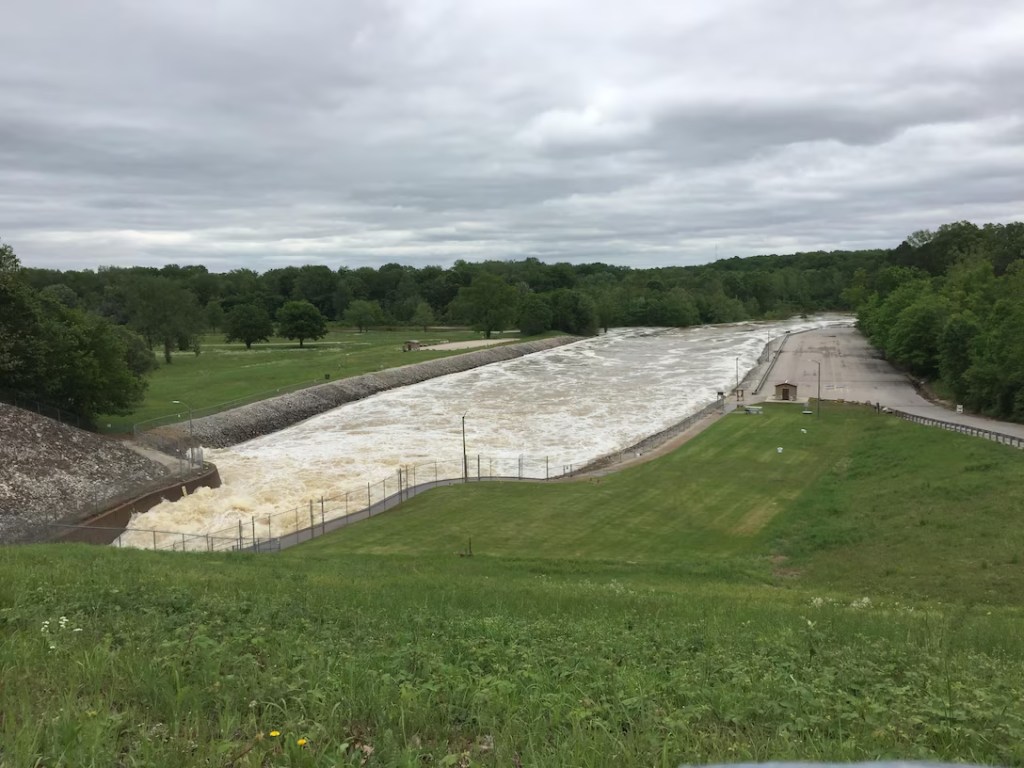
The county seat resumed life at its new location. Greenville kept its name, its government, and many of its houses. What remained behind was an orderly pattern of streets gradually filling with grass.
Where the Streets Still Run
Today, Memory Lane follows those streets through the Greenville Recreation Area. Visitors can walk along Fourth Street, turn toward Main, and pass concrete steps once climbed by children returning home from school or neighbors stopping by for a visit. Old foundations sit among the trees. Interpretive panels show photographs of houses and businesses in the places where they stood, allowing the present landscape to flicker briefly into its earlier form.
The Army Corps of Engineers describes Memory Lane as a trail through the remaining sidewalks and foundations of the old town. The surrounding Old Greenville historic site has been listed on the National Register of Historic Places since 1990. Union Cemetery survives within the recreation area as well, its graves reaching back through the community’s earlier history. The cemetery stayed in place as the houses traveled north, leaving the old town with some of its first residents and the names of families whose descendants had moved away.
For more than three decades, people have returned each September for Old Greenville Days, filling the former town site with music, crafts, historical tours, and living-history demonstrations. The campground also hosts an annual rendezvous encampment each spring. In 2026, that gathering marked its 47th consecutive year, which means the old town has now spent nearly half a century welcoming reenactors. History here has developed a sociable afterlife.
The water still occasionally interrupts. The recreation area occupies part of the reservoir’s flood-control zone, and high lake levels can close sections of the campground. In 2025, flooding forced organizers to postpone the spring rendezvous until September, when it ran alongside Old Greenville Days instead. The old town site continues to do the work Greenville surrendered it for, receiving the water so the new town can remain uphill.
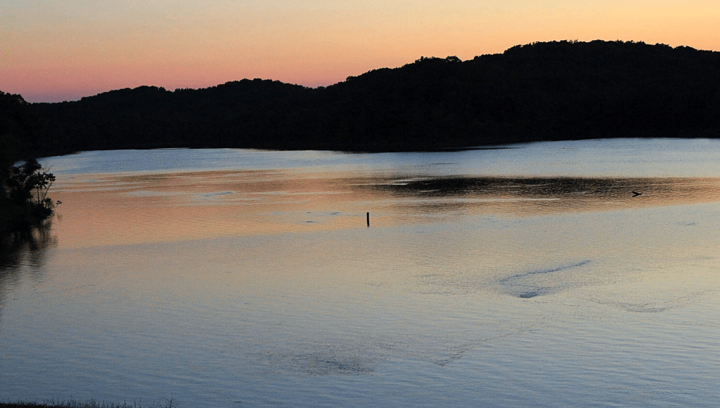
That may be the most affecting part of Old Greenville. Its residents left because they understood the river would keep returning, yet they carried enough of the town with them for Greenville to continue. The courthouse vanished, and the houses found new foundations, while the original sidewalks settled quietly into the campground.
The people who knew Old Greenville as home are mostly gone from the ground beside the lake. Their sidewalks, somehow, are not.
Further Reading
- Wappapello Lake Recreation, U.S. Army Corps of Engineers, St. Louis District
- Old Greenville (23WE637), National Register of Historic Places, National Park Service
- Old Greenville in 1940 – Before the Wappapello Dam, Historical Marker Database
- Old Greenville – Hiram N. Holladay’s Company Town, Historical Marker Database
- Alice J. Curtice Moyer-Wing, The Ozark Suffragist, Historical Marker Database
- Old Greenville – April 22, 1939, Historical Marker Database
- Almost Yesterday: The Great Greenville Flood, KRCU Public Radio
- A Lakeside Ozark Escape, Missouri Life
- Alice Curtice Moyer Wing columns, Missouri Women
Continue Reading Hidden Missouri History:
- The Ghost Town Where I Held My Breath: The Strange Second Life of Times Beach
- Missouri’s Fault Is Quiet. Nobody Knows Why.
- Zombie Road: The Story Beneath Missouri’s Most Haunted Trail
- Castlewood: The Summer Resort Beneath One of St. Louis’s Favorite Parks
- Weldon Spring: The Radioactive Mountain You Can Climb Near St. Louis
- The Prison Camp Missouri Farmland Swallowed Whole






Leave a comment