
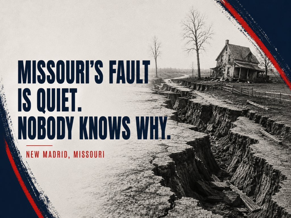
Two centuries after the New Madrid earthquakes caused the Mississippi to change its course, scientists can’t agree on whether the fault is dying or quietly reloading.
By Jill Szoo Wilson
Writer | Theatre Artist | Educator
When I was seven years old, my mom and I moved from St. Louis to Los Angeles. About a year later, I experienced my first earthquake.
I remember glass figurines falling from my bookshelf and breaking. A large corner cabinet toppled toward my bed, spilling stuffed animals across the floor. We ran downstairs and into the street, where an entire neighborhood had gathered, families speaking different languages and trying to understand together what had just happened and what might come next.
That summer, back in St. Louis, I regaled my grandma with the story of what it was like to live through a rather large earthquake. When I finished, she had one for me. I listened wide-eyed as she told me about the New Madrid fault beneath the Mississippi Valley and the massive earthquakes that had once shaken the middle of the country. She told me that the Mississippi River had run backward, that the shaking reached all the way to Boston, and that scientists believed another great earthquake could someday strike the same stretch of the Midwest.
I question her timing. I was already a scaredy-cat.
But the story stayed with me.
A few years later, the rest of St. Louis seemed to catch up. In 1990, a prediction spread that a massive New Madrid earthquake would strike on December 3. Schools closed. People stocked emergency supplies. News crews descended on New Madrid to wait for the ground to move. The prediction had no scientific basis, and December 3 passed quietly. But for a while, an entire city seemed to be waiting for the earthquake my grandma had first told me about years before.
At around two in the morning on December 16, 1811, the ground beneath New Madrid, Missouri, rose and fell in waves. Trees bent toward the ground. Great cracks opened across fields. Sand and water burst through the soil. Along the Mississippi River, boat captains watched the current reverse and waterfalls form where moments earlier the river had flowed normally. The shaking traveled so far that church bells rang in Boston, more than a thousand miles away.
The earthquake was only the beginning.
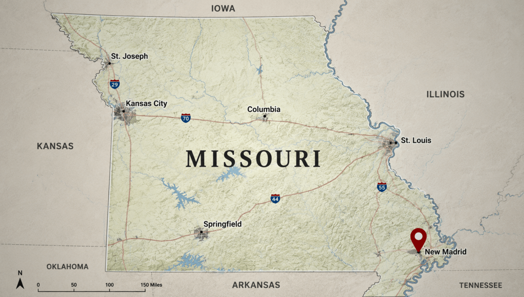
Two more shocks of comparable power followed within the next two months, on January 23 and February 7, 1812, and thousands of smaller aftershocks kept the ground moving for more than a year afterward, according to the U.S. Geological Survey (USGS). Modern seismologists estimate that the three main shocks each had magnitudes above 7, placing them among the largest earthquakes ever recorded in the contiguous United States and the most powerful east of the Rocky Mountains.
That’s a remarkable amount of movement for a part of the country few people think of as earthquake territory.
California’s earthquake risk is relatively easy to see on a map. The state straddles the boundary between the Pacific and North American plates, where enormous pieces of the earth’s crust move past each other and build up stress. New Madrid is different. It sits deep inside the North American Plate, hundreds of miles from any plate boundary, along the buried remains of an ancient rift where the continent began to split apart hundreds of millions of years ago. The split stopped. The earthquakes did not.
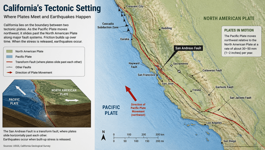
The difference becomes even stranger when the shaking travels. The New Madrid earthquakes shook an area roughly ten times larger than the 1906 San Francisco earthquake and two to three times larger than the 1964 Alaska earthquake, the largest ever recorded in North America. The reason lies in the ground itself.
Western bedrock is young and fractured, full of small breaks that absorb seismic energy as it travels. Beneath the central and eastern United States, the rock is older and far more continuous, carrying seismic waves the way a struck bell carries sound. In California, seismic energy generally fades more quickly as it travels. In Missouri, the shaking can carry for hundreds of miles. That is how an earthquake centered in a small river town managed to ring church bells in Massachusetts.
New Madrid itself, home to a few hundred people by most accounts, though a firsthand 1813 diary entry puts the figure closer to a thousand, was largely destroyed. Farther east, land near the Mississippi sank by several meters in places, and the river poured into the resulting basin to form what is now Reelfoot Lake in Tennessee. Because the region was still a frontier country, sparsely settled and far from any major city, the human toll remained relatively small. A comparable sequence striking the same footprint today would reach Memphis, St. Louis, and a dozen smaller cities now home to millions of people.
Geologists have since found evidence that 1811 and 1812 belong to a much longer pattern. Digging into the soil around the region has revealed sand blows and liquefaction features from at least two earlier clusters of large earthquakes, one around the year 900 and another around 1450, while other evidence extends the zone’s known seismic history back roughly 4,500 years. Spaced out across centuries, those clusters suggest a rough rhythm: major sequences returning every few hundred years. On that reading, the New Madrid Seismic Zone looks less like a historical curiosity than a fault capable of repeating itself.
That history helps explain the risk estimates used by the U.S. Geological Survey. The agency has long put the odds of a magnitude 7 or larger earthquake striking the New Madrid zone at somewhere between 7 and 10 percent over the next fifty years, with a considerably higher chance, roughly a quarter to just under half, of a magnitude 6 event in the same period. FEMA and the Mid-America Earthquake Center have separately modeled a repeat of the sequence and put the toll at roughly 86,000 casualties, 7.2 million people displaced, and direct economic losses close to 300 billion dollars, largely because so much of the region still relies on buildings constructed long before earthquake resistance entered local building codes.
The same body of evidence, however, supports a very different conclusion, depending on which scientist you ask.
Beginning in the late 2000s, a research team led by seismologist Seth Stein at Northwestern University, working with Eric Calais and other colleagues, set out to measure something that had rarely been captured with real precision before: exactly how fast the ground on either side of the New Madrid fault system is actually moving. They installed a network of roughly two hundred GPS stations across the central United States. They tracked their positions for up to fourteen years, publishing the results in the Journal of Geophysical Research in 2014.
If the fault were steadily accumulating strain the way most active faults do between major earthquakes, the stations on either side should have crept apart or together at a measurable rate. Instead, the team found movement of no more than about 0.2 millimeters a year, roughly two hundred times slower than the San Andreas Fault, which moves at up to 37 millimeters a year across California.
Stein’s interpretation of that result, laid out in his book Disaster Deferred, is provocative. If the fault genuinely sits nearly frozen at depth, then the small earthquakes still rattling the region today may simply be the extraordinarily long tail of aftershocks from 1811 and 1812, the earth still settling more than two centuries later. Under that reading, the cluster of large earthquakes that built Reelfoot Lake may have marked the end of an active seismic period rather than the opening act of another one. The next comparable sequence could lie thousands of years away rather than mere centuries.
The USGS has pushed back on this interpretation, and the objection carries real weight. One problem is that the small earthquakes still occurring in the zone, several hundred a year, have stayed fairly steady rather than fading the way a genuine aftershock sequence typically does, growing rarer as decades pass. Another lies in the scale of time itself. Fourteen years of GPS measurement is a genuinely tiny window against a paleoseismic record stretching back thousands of years. A fault capable of remaining quiet for centuries between major clusters could easily produce a decade or two of nearly zero surface strain, a quiet period that may reveal very little about what is happening farther down.
And so the argument remains.
Both sides agree on the history: New Madrid produced some of the largest earthquakes ever recorded on this continent, and the ground beneath a wide stretch of the Mississippi Valley has done this kind of thing before, more than once, across thousands of years. What remains genuinely unresolved is the meaning of the silence. Is the fault winding down after its last great performance, or is it simply resting mid-cycle, the way it apparently has for centuries at a stretch before?
Somewhere under the soybean fields and river towns of southeastern Missouri, the fault that flooded a lake into existence and rang bells in Boston is either quietly dying or quietly reloading. Even the scientists who have spent careers measuring it in millimeters have yet to settle on which.
Millions of people now live directly on top of the answer, going about an ordinary Tuesday morning in a stretch of the country few of them ever think of as earthquake territory.
Further reading
United States Geological Survey, Summary of 1811-1812 New Madrid Earthquakes Sequence (usgs.gov)
United States Geological Survey, Earthquake Hazard in the New Madrid Seismic Zone Remains a Concern (usgs.gov)
Encyclopedia of Arkansas, New Madrid Earthquakes of 1811-1812
Encyclopaedia Britannica, New Madrid earthquakes of 1811-12
Mid-America Earthquake Center and the Institute for Crisis, Disaster and Risk Management, Impact of New Madrid Seismic Zone Earthquakes on the Central USA, prepared for FEMA (available through the University of Illinois IDEALS repository)
Craig, T. and Calais, E., Strain accumulation in the New Madrid and Wabash Valley seismic zones from 14 years of continuous GPS observation, Journal of Geophysical Research: Solid Earth, 2014
Seth Stein, Disaster Deferred: How New Science Is Changing Our View of Earthquake Hazards in the Midwest (2008), and New Madrid Seismic Zone: A Cold, Dying Fault? (Northwestern University)



 Jill Szoo Wilson
Leave a comment