
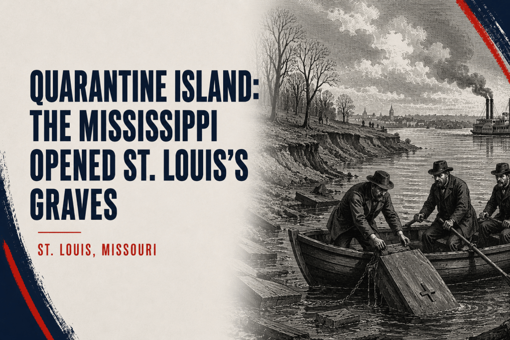
St. Louis moved cholera victims from what is now Benton Park to an island in the river. Within a generation, the island itself was gone.
By Jill Szoo Wilson
Writer | Theatre Artist | Educator
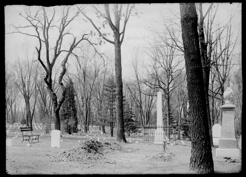
On a summer afternoon, Benton Park lies beneath deep green shade. The pond reflects the old brick bridge and the surrounding canopy, geese move along the water’s edge, and families gather near paths that wind through the fourteen-acre park. Nothing in the calm landscape suggests that this was once the City Cemetery, or that generations of St. Louis’s dead were buried beneath the ground.
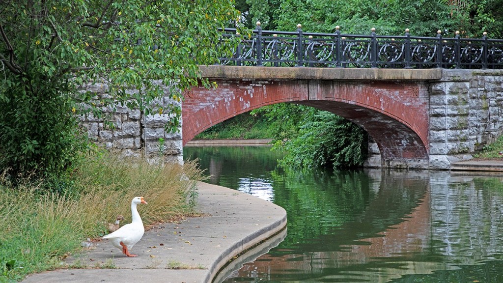
Before Benton Park became a park, it was the City Cemetery. In 1865, workers began exhuming many of the people buried there, including victims of the catastrophic cholera epidemic of 1849, and carried their remains to a low island in the Mississippi River. The city opened Benton Park the following year, while the bodies went to a burial ground surrounded by water and placed at what must have seemed like a safe distance from the living.
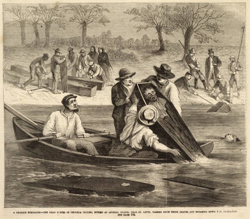
Three years later, coffins from the island were floating down the Mississippi. The front page of the May 16, 1868, edition of Frank Leslie’s Illustrated Newspaper showed men in a rowboat pulling an open coffin from the water while other coffins and bodies drifted around them. The engraving carried a title almost too awful to require explanation: “A ghastly spectacle—the dead bodies of cholera victims, buried at Arsenal Island, near St. Louis, washed from their graves and floating down the Mississippi.” The river had reached the cemetery, and in time it would take the entire island.
The Epidemic That Changed St. Louis
The story begins in 1849, one of the most disastrous years St. Louis had yet endured. The city was growing rapidly as immigrants arrived from Europe and travelers gathered at the riverfront before continuing west. Steamboats crowded the levee, carrying people and cargo into a city whose population had expanded faster than its sanitation systems could manage.
In May, the Great Fire swept through the riverfront, destroying hundreds of buildings and more than twenty steamboats. Cholera brought the greater loss. St. Louis records estimate that roughly one-tenth of the city’s population died during five months of the epidemic, with the weekly death toll reaching 639 at its height. Church bells sounded so frequently that one eyewitness described a city where “the stoutest hearts begin to quail” and little could be heard beyond the tolling of the cathedral bell.
Cholera attacks the intestines after a person consumes food or water contaminated with the bacterium Vibrio cholerae. In severe cases, the body can lose fluid with terrifying speed. St. Louisans in 1849 had yet to understand that chain of transmission.
The city responded with the tools available to it. Officials cleaned streets, began expanding the sewer system and inspected people arriving by river. They also turned toward a piece of land that seemed perfectly designed for keeping sickness outside the city: an island near the Missouri bank of the Mississippi, south of downtown and opposite the federal arsenal.
The Island Every Boat Had to Visit
St. Louis made its quarantine station permanent in 1850. The island appears in historical records under several names, including Quarantine Island, Arsenal Island and, later, Smallpox Island. A federal survey completed in 1863 measured approximately 120 acres, although the river had already altered its shape considerably by then.
Every boat bound for St. Louis had to stop there and unload its passengers and baggage for inspection. The city erected buildings capable of housing as many as 500 people. During Mayor Luther Kennett’s administration, approximately 2,500 travelers were detained for periods of three to five days, while 120 remained longer because officials believed their conditions required further isolation.
For a nineteenth-century traveler, the interruption would have carried its own kind of dread. After days or weeks aboard a crowded steamboat, the St. Louis skyline would finally appear upriver, close enough to promise lodging, work or reunion with family. Then the boat would stop short of the city. Passengers would climb ashore with their belongings and wait for someone to decide whether they could continue.
The quarantine station reflected the city’s limited medical understanding, but it also reveals how completely St. Louis depended on the river. The Mississippi served as the route by which newcomers entered, goods arrived and disease traveled. Placing the inspection station on an island allowed officials to stand between the river and the city, examining each boat before its passengers stepped onto the levee.
The island soon carried more than the temporary weight of the living. It became a place for the dead whom St. Louis wanted removed from other ground.
The Cemetery Beneath Benton Park
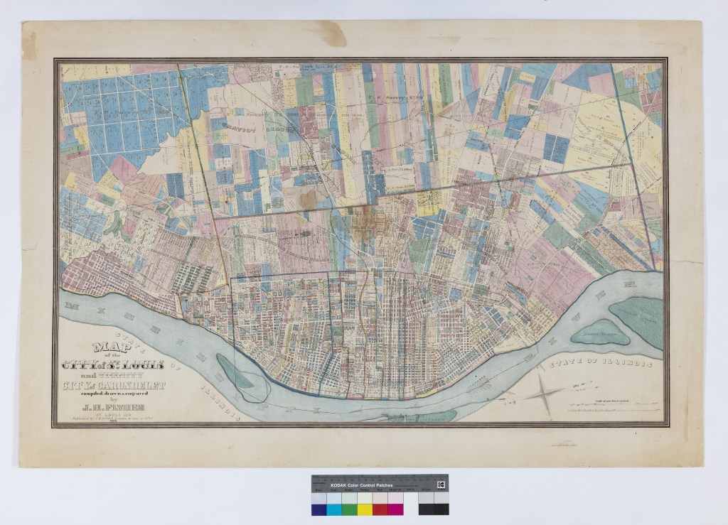
The land that became Benton Park had been reserved for use as a city cemetery when St. Louis began selling portions of the old commons in the 1830s. By the time the city chose to create a public park there, Bellefontaine and Calvary cemeteries had opened farther north, offering new places for burial beyond the increasingly crowded neighborhoods of the growing city.
Turning a cemetery into a pleasure ground required more than a new ordinance and landscaping. The bodies had to be moved.
Many of the people exhumed in 1865 had died during the 1849 cholera epidemic. Their graves were opened, their remains gathered and their coffins transported from the former City Cemetery to the burial grounds on Arsenal Island. On June 25, 1866, St. Louis created what it first called City Park on the emptied land. The park later took the name of Missouri senator Thomas Hart Benton, and the neighborhood around it grew into rows of brick houses, breweries and shops.
The transfer carried the dead from one changing landscape into another. Benton Park sat on land the city wanted to reclaim for urban life, while the island offered distance and apparent permanence. Water separated the burial ground from nearby homes, and the river appeared to provide a natural boundary around land that no developer would need. The Mississippi had already begun remaking it.
The Island Becomes a Military Hospital
During the Civil War, the federal government occupied part of Arsenal Island as a military hospital and burial ground. People who died at the hospital were buried there, and cemetery records later listed the site under several names, including Small Pox Island. About 470 smallpox victims from Arsenal Island were eventually reinterred at Jefferson Barracks National Cemetery, preserving at least part of the burial ground before the river completed the destruction already underway.
The island had become a place where the city and the military sent people whose illnesses made them dangerous to crowded institutions onshore. Travelers waited there for permission to enter St. Louis. Sick soldiers received treatment there. The dead from the old City Cemetery arrived after their original burial ground became valuable for another use. Each decision depended on the same assumption: the island would remain where the city had placed it.
When the Mississippi Opened the Graves
A river island is less permanent than it appears from shore. The Mississippi carries enormous quantities of sand and soil, cutting into one bank while building land along another. Channels migrate, sandbars rise, and pieces of ground that appear stable on one survey can change dramatically before the next map is drawn.
Quarantine Island stood near the Missouri side of the river in 1853. At low water in 1858, it had grown close enough to touch the mainland. During the same decade, however, the current began tearing away other portions of the island. A federal court would later determine that most of the land shown in the 1853 survey had disappeared by 1863.
The erosion reached the burial grounds. In the spring of 1868, reports spread that the current had opened graves and released coffins into the Mississippi. The engraving published by Frank Leslie’s Illustrated Newspaper showed workers retrieving the dead from the water while more coffins waited along the collapsing bank.
The image transformed a local public-health failure into a national spectacle. St. Louis had removed cholera victims from the center of a neighborhood and placed them beyond ordinary view. The Mississippi returned them in the most visible way possible, carrying coffins past river towns downstream.
Officials continued using the island for several more years, even as the ground beneath it changed. St. Louis occupied the quarantine site until 1875, but the original island was steadily vanishing while new deposits formed farther downriver.
That movement eventually created a question strange enough to reach the United States Supreme Court: When a river washes away an island and builds new land somewhere else, does the city still own it?
The Island That Ended Up in the Supreme Court
The legal dispute began after land appeared downstream near the Illinois shore. St. Louis argued that the new ground had formed as an extension of Arsenal Island and therefore belonged to the city. Illinois landowners claimed it had accumulated within the boundaries of their riverfront property.
By the time the case reached the Supreme Court in 1891, the judges had to reconstruct decades of shifting channels, floods and surveys. Witnesses described enormous pieces of shoreline falling into the Mississippi during high water. In some places, the river removed strips of land hundreds of feet wide. A city block’s worth of earth could disappear within a day or two.
The findings settled the fate of the quarantine station more clearly than any surviving map. No land remained above the water within the boundaries of Quarantine Island as surveyed in either 1853 or 1863. The original island had been wholly washed away. The newer land had formed separately, and the Court rejected St. Louis’s attempt to claim it as a surviving part of the island the city had purchased.
The legal distinction was precise. Popular memory might describe an island drifting or moving across the river, but islands do not travel intact. The Mississippi dismantled Quarantine Island and deposited other material elsewhere. The land that carried the hospital and cemetery ceased to exist above the surface, while a different body of land emerged downstream. The city retained title to the submerged site, but the island itself no longer rose above the Mississippi.
What Remains of Quarantine Island
There is no historic building to visit and no trail following the island’s former shoreline. The Mississippi flows across the boundaries recorded in the nineteenth-century surveys, and the land where passengers waited, soldiers died and cholera victims were reburied lies beneath the river.
The story survives in places that appear separate until their histories are placed beside one another. Benton Park still occupies the old City Cemetery, its lake and paths laid across ground from which many bodies were removed before the park opened in 1866. Jefferson Barracks National Cemetery holds hundreds of people recovered from Arsenal Island, including approximately 470 smallpox victims whose remains escaped the river’s final claim.
The engraving preserved by the Missouri Historical Society gives the vanished island its most disturbing visual record. Men lean from a small boat toward an open coffin, while the St. Louis riverbank rises behind them. The image captures the moment when the boundary the city had created between itself and its dead gave way.
Today, Benton Park gathers people beneath mature trees where the city once buried its cholera victims, and Jefferson Barracks keeps the remains of hundreds carried away from the island before the river finished its work. Somewhere between those places, south of downtown, the Mississippi passes over the former site of Quarantine Island.
The city left no monument there because there is no ground left to hold one.
References
City of St. Louis. (n.d.). Benton Park. Retrieved July 22, 2026, from https://www.stlouis-mo.gov/government/departments/parks/parks/browse-parks/view-park.cfm?parkID=17&parkName=Benton+Park
City of St. Louis. (n.d.). Benton Park neighborhood overview. Retrieved July 22, 2026, from https://www.stlouis-mo.gov/live-work/community/neighborhoods/benton-park/benton-park-overview.cfm
City of St. Louis. (n.d.). Cholera epidemic. St. Louis Historic Preservation. Retrieved July 22, 2026, from https://dynamic.stlouis-mo.gov/history/eventdetail.cfm?Master_ID=522
City of St. Louis. (n.d.). Cholera quarantine made permanent. St. Louis Historic Preservation. Retrieved July 22, 2026, from https://dynamic.stlouis-mo.gov/history/eventdetail.cfm?Master_ID=318
City of St. Louis. (n.d.). Fire Department history. Retrieved July 22, 2026, from https://www.stlouis-mo.gov/government/departments/public-safety/fire/fire-department-history.cfm
City of St. Louis. (n.d.). James G. Barry. St. Louis Historic Preservation. Retrieved July 22, 2026, from https://dynamic.stlouis-mo.gov/history/peopledetail.cfm?Master_ID=961
City of St. Louis. (n.d.). Luther M. Kennett. St. Louis Historic Preservation. Retrieved July 22, 2026, from https://dynamic.stlouis-mo.gov/history/peopledetail.cfm?Master_ID=962
City of St. Louis, Cultural Resources Office. (1995). The relationship between people and government. In A preservation plan for St. Louis. https://www.stlouis-mo.gov/government/departments/planning/cultural-resources/preservation-plan/Part-I-People-and-Government.cfm
Frank Leslie’s Illustrated Newspaper. (1868, May 16). A ghastly spectacle—the dead bodies of cholera victims, buried at Arsenal Island, near St. Louis, washed from their graves and floating down the Mississippi [Newspaper engraving]. Missouri Historical Society, via Wikimedia Commons. https://commons.wikimedia.org/wiki/File:%22A_ghastly_spectacle_-_the_dead_bodies_of_cholera_victims,_buried_at_Arsenal_Island,_near_St._Louis,_washed_from_their_graves_and_floating_down_the_Mississippi.%22_-_DPLA_-_8461432426b24fc85ee436563dcfd873_(page_1).jpg
Saint Louis University Archives. (n.d.). St. Louis cholera epidemic and fire, 1849 [Archival collection description]. Retrieved July 22, 2026, from https://archives.slu.edu/repositories/2/archival_objects/12192
St. Louis County Library. (n.d.). St. Louis cemeteries—A. Retrieved July 22, 2026, from https://www.slcl.org/research-learn/genealogy/st-louis-cemeteries/A
St. Louis v. Rutz, 138 U.S. 226 (1891). https://www.govinfo.gov/app/details/USREPORTS-138/USREPORTS-138-226
U.S. Department of Veterans Affairs, National Cemetery Administration. (n.d.). Jefferson Barracks National Cemetery. Retrieved July 22, 2026, from https://www.cem.va.gov/CEM/cems/nchp/jeffersonbarracks.asp
World Health Organization. (2024, December 5). Cholera. https://www.who.int/news-room/fact-sheets/detail/cholera
More Hidden Missouri History
- The Ghost Town Where I Held My Breath: The Strange Second Life of Times Beach
- Missouri’s Fault Is Quiet. Nobody Knows Why.
- Zombie Road: The Story Beneath Missouri’s Most Haunted Trail
- Castlewood: The Summer Resort Beneath One of St. Louis’s Favorite Parks
- Weldon Spring: The Radioactive Mountain You Can Climb Near St. Louis
- The Prison Camp Missouri Farmland Swallowed Whole
- Memory Lane: A Missouri Ghost Town You Can Still Walk Through






.jpg)
Leave a Reply